One of my “adopted” children asked me recently what I might know about a Civil War battle in the Bowling Green area. I have covered the Civil War in a few segments, mainly on Fort Williams here in Glasgow, and the Confederate occupation in this area. It is known by most Civil War historians that Bowling Green was the Confederate Capital of Kentucky for a short time at the start of the conflict. for Civil War buffs, there is an 18-point driving tour in Bowling Green that takes you to specific sites, where the state has placed markers to identify the sites.
General Simon Bolivar Buckner led about 4,000 troops to occupy Bowling Green in September of 1861. Bowling Green was considered one of the state’s most strategic cities. General Albert Sidney Johnston chose Bowling Green for his headquarters.
After meeting in Russellville, Bowling Green was declared the Confederate State Capital in November 1861. After the Union won battles for forts in Tennessee over the winter, Union General Don Carlos Buell brought his Army of the Ohio southward from Green River in early 1862. Under General Ormsby Mitchell’s command, Bowling Green was bombarded from across Barren River. In mid-February 1862, Bowling Green fell into Union hands.
Herein follows the 18 Civil War Historical sites that make up the Bowling Green Civil War Discovery Trail:
1) Lost River Cave and Valley – 2818 Nashville Road (US 31-W). John Hunt Morgan was purported to have hidden out here after one of his raids.
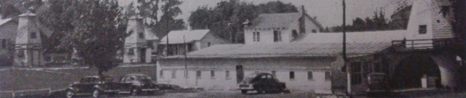
Octagon Hall, 10 miles south of Lost River Cave, near Franklin, on US 31-W, is where the Confederate army camped after evacuating Bowling Green.
2) Jonesville – on the Western Kentucky University Campus. An African-American community, founded in 1867 by emancipated slave, Charles L. Jones. At its height, there were several hundred residents, a school, businesses, and 2 churches.
3) The Confederate State Capital (State Marker 67) is currently housing the Kentucky Museum and Library on the WKU campus, off of Hwy 68/80.
4) Fort Lytle was located on the WKU campus, on the summit of the hill. It was also known as Fort Vinegar. Take College Heights Blvd. to enter the hilltop campus at Gordon Wilson Hall, just past Van Meter Hall, to reach the hilltop parking lot.
The Fort Albert Sidney Johnston Plaque, WKU, is behind Cherry Hall, near the summit of Campus Hill. It has never been proven that Fort Lytle was ever called Ft. Albert Sidney Johnston.
5) Grider House – 1320 Park Street. Antebellum home owned by a Union sympathizer. A garrison of Confederate soldiers was stationed to protect this home as the residence of the Confederate governor. This hill also contained a “lunette fort” and 3 mounted cannon.
6) College Hill (State Marker 1051) at Main and Park Streets, at the entrance to Reservoir Park.
Fort CF Smith was located south of town on what is now known as Reservoir Hill. Some earthworks are still visible. Construction was under command of Colonel Benjamin Harrison, who later became President of the United States. This was the largest and most elaborate fort in the Bowling Green defensive system. It was described as a “bastion fort” and was designed to mount up to 25 cannon.
7) Civil War Occupation (State Marker 1024) – On Main St. in Fountain Square Park. There is also a stone monument in the park recognizing Bowling Green as the Confederate Capital of Kentucky.
8) A marker at the Warren Co. Courthouse (State Marker 1201), recognizes Warren County’s Chief Union Civil War Officers and lists those who received Confederate Medals of Honor in 1863. Warren Co. Courthouse is one block south of Fountain Square on the corner of College and 10th Sts.
9) Baker Hill (State Marker 1049) is north of Bowling Green on KY 3225, known as Old Louisville Road. It is on private property, across the street from Weldon Peete Park, where parking is available.
A reenactment called “Battle for the Barren Civil War Encampment” is held at Baker Hill. Fort Baker stood on a hill north of the city on Barren River to defend Bowling Green against troops coming from the north and east. From here, Gen. Ormsby Mitchell launched his bombardment of Bowling Green while the Confederate army evacuated the city.
10) Defending the L&N Railroad – at River Walk Park, East Riverview Drive. The original trestle was destroyed by the Confederates to prevent the Union army from entering Bowling Green by rail. After the trestle was repaired by the Union army, a defensive stockade was also built to protect this important river crossing.
11) Historic Railpark and Train Museum – 401 Kentucky Street. Confederate forces burned the train depot as they evacuated Bowling Green before the Union advance. The train station that is there now was built in 1925, and lies on the track bed of the original L&N Rail line.
12) A Civil War Defense Line (State Marker 538) is at 2nd and College Sts., US 31-W and Hwy 68. This spot marks the end of a defensive rifle trench. This trench began next to the L&N Railroad tracks and then zig-zagged its way to the center of what is now Roland Bland Park. It is halfway between Fort CF Smith and Fort Webb. It continues to Center St. near 8th Avenue.
13) Riverview at Hobson Grove – 1100 West Main Street (State Marker 1127).
Construction of Hobson House began in 1857, but was not finished until after the Civil War. During occupation by both Confederate and Union troops, the house’s foundation and four walls were used as a fort, while the basement was used as an ammunition depot for the entire fortification system in Bowling Green.
14) Hines Boatlanding Park – Boatlanding Rd. – which takes you across the historic Richardsville Bridge. The Big Barren River was a major contributing factor to making Bowling Green a strategic location for both armies. This is only about one mile from Hobson Grove.
15) Fort Webb Park – Beech Bend Rd. and Country Club Drive. Now a city park, this fort retained its original configuration since it was constructed by the Confederate army. It was described as a “lunette fort with embankments,” and 3 mounted cannon. There is a map located here of the Civil War fortifications in Bowling Green.
16) Mount Ayr and Fort Underwood – Kereiakes Park.
Atop Underwood Hill to the northeast stood Mt. Ayr, home of the Warner Lewis Underwood family. The family was forced out of Bowling Green after 3 Confederate soldiers arrived on their property bearing an eviction notice from the Underwood property. One of their sons was a Union officer, which probably had some bearing on these orders.
In her diary, Warner Underwood’s daughter Josie wrote:
“Father held the paper so we could all see it and it read: Warner L. Underwood and all persons occupying the buildings on Underwood Hill, Commonly known as Mount Air, are requested to vacate the premises immediately. By the orders of Gen commanding, etc etc. It was like a low blow that stunned us. Ma sank in a chair, white and speechless. Our time has been extended to tomorrow, when we must go. God knows where and for how long – perhaps forever.”
Officers and their wives lived in Mt. Ayr until the Confederates abandoned Bowling Green in February 1862. Josie also wrote of the Underwood Homecoming on February 13, 1862:
“When we reached the bounds of Mt. Ayr on what is now Cemetery Pike, all fences were gone, so we drove across the fields to the house. Just as we drove up the last wall fell with a crash. The house perished – one of the oldest and handsomest in Warren County.”
Near the home, Fort Underwood was constructed to defend Barren River and the Glasgow Rd. Ft. Underwood was described as a “lunette fort,” with 6 mounted cannons. From 31-W bypass, turn onto Fairview Ave. and go about half a mile. Turn left into Kereiakes Park, next to Fairview Cemetery.
17) Mt. Moriah Cemetery – St. Joseph’s Lane, between Fairview Cemetery and Kereiakes Park. This is a black cemetery that was established in the 1870s, which includes several graves of Union soldiers.
18) The Confederate Monument, located in the section of Fairview Cemetery on the same side of the avenue as Kereiakes Park, was dedicated in 1976 before 12,000 people. Several hundred bodies were moved to this site, and are believed to be buried encircling the obelisk carved from local sandstone. Outside the cemetery gates, a historic marker identifies Thomas Henry Hines, a Butler Co. native and Confederate spy once known as the most dangerous man of the Confederacy. (State Marker 769 – 1209 Fairview Ave.). It is noted that the man was once mistaken for John Wilkes Booth!
In parting, Pioneer Cemetery is at the corner of College and Center Streets. It also has graves of several Civil War soldiers.
Categories
Archives
Urban legends of barren
- 1918 Flu
- Allen Co KY
- Alonzo McClellan
- Austin-Tracy
- Barren Circuit Court
- Barren County Jail
- Barren River
- Beaver creek
- Beckton KY
- Bob Brown
- Bowles family
- Bowling Green Ky
- Boyds Creek
- Broadway
- Buffalo Ford
- burial customs
- Burkesville Rd
- Cave City
- cave lore
- CC Simmons
- Civil War
- Columbia Avenue
- drowning
- East Main Street
- Edmonton Hwy
- executions
- Falling Timber Creek
- family history
- Fountain Run
- Franklin Gorin
- Front Street
- Glasgow Cemetery
- Glasgow Junction
- Glasgow KY
- Glasgow Public Square
- Glasgow Times
- Gorin family
- Green mansion
- Hallowe'en
- hangings
- Hwy 63
- Hwy 249
- Indian history
- Jimmy Simmons
- John Franklin
- John Miller Dugard
- Kinslow family
- L&N Railroad
- Leslie Triangle
- local history
- Louisville KY
- Mammoth Cave
- Martha's Divine Hole
- May Street
- Metcalfe Co
- murders
- New Salem Cemetery
- North Race Street
- Oil Well Rd
- Peter Creek
- Randolph KY
- Roseville KY
- sheriffs and deputies
- Skaggs Creek
- Slick Rock
- Southfork Creek
- South Green Street
- suicides
- tragedy
- US68-80
- Warren Co KY
- Water Street
- Western Kentucky University
- West Washington Street
- Zion Huggins

I find your stories very interesting and informative. I recently travelled to Bowling Green and in particular, Lost River Cave where John Hunt Morgan hid.What is of further interest to me is the fact that John Hunt Morgan had Welsh decendancy which is the country of my birth. The more I look into facts of the civil war, the more I learn of the Welsh influence involved,